Sunday, October 19, 2014

Cuzco and the Sacred Valley -- Our Inca Journey: Days Three and Four

(Hint: Scroll down to see our adventures from Days One and Two!)

The alarm went off that morning at 5:15 a.m., but it was unnecessary as the roosters had been crowing since well before dawn. After a hasty breakfast, we boarded a bus at around 7 a.m. that would take us up the mountain. I sat in a window seat which was very fortunate because I got an amazing view of our ascent. The road that the bus takes up to Machu Picchu is winding and serpentine, zig-zagging up the mountainside. Every time the bus turned to my side, I got an amazing view of the mountains surrounding the valley in which Aguas Calientes lies. The mountains in this section of the Andes are huge, giant monoliths covered in dense, thick, dark green foliage. They are so high, misty white clouds swirl around the tips and dip down into the valley.


The ruins of Machu Picchu with the peak Huayna Picchu rising majestically in the background. 
With about five minutes left in our bus journey, Marion drew my attention to the window where I got my first glimpse at the site itself, dwarfed in size and splendor by the mountains all around. Upon arriving at the archaeological site of Machu Picchu, we were among the first tourists there, meaning it wasn't as congested. Machu Picchu typically receives between 1,000 and 1,500 visitors a day, so it's best to go earlier when it is less crowded and much cooler.

The first think Patrick did was take us up to the ruins of the agricultural terraces overlooking the main ruins so that we could take iconic photos of the site (see above!). Machu Picchu means 'old mountain' and is actually the name of the mountain peak opposite the ruins. Nobody knows what the original name of Machu Picchu was, just as nobody is exactly sure of its purpose. Patrick said it was probably constructed in 1440 or 1450, had its peak in 1480 or 1490, and was deserted by 1520. No one knows why it was deserted -- maybe disease, maybe news of the Spanish arrival, maybe a mass exodus to fight in the civil war between Atahualpa and Huascar. 

These are the huge, majestic mountains capped with fluffy clouds that surround Machu Picchu on all sides. 
The mountains that ring Machu Picchu are incomprehensibly large and are covered in foliage. They are very different from the mountains outside of Lima, the mountains at Cuzco, those at Ollantaytambo or those in the Sacred Valley. You simply stand on a ridge with a clear view and become absolutely entranced. It's like you can't pull your eyes away, and you never get tired of looking at it.

A deliberate rock formation within the ruins that is thought to mirror the shape and slope of the mountains behind it. 
After taking our fill of pictures, we descended into the ruins themselves. The ruins feel more "real" than do any of the other ruins we had seen on the trip. It's so easy to imagine a settlement of 500 to 700 people living there, and as you round a corner, it's almost as if you are just a step behind an Inca as he moves throughout the city. The ruins themselves are impressive, and I can only imagine what Machu Picchu must have looked like in its prime, a glittering jewel in the heart of the Andes Mountains. Some theorists believe that the site existed as a summer home for the Inca royalty of Cuzco, but to a culture that held religion in such high regard, the site is in a location far too beautiful and powerful to have just been used solely for leisure.

The so called "Temple of the Condor" inside the ruins. The curved rocks look like the spread wings of the famous bird. Hiram Bingam named a lot of the formations when he came upon the site in 1911, and thus they should not be considered the true names given by the Incas who lived here in their time. 

Me standing at the edge of the stairs to nowhere -- they drop down nearly vertically after this point almost all the way to the valley floor. 
After we finished our tour of the ruins, the majority of the group decided to hike up the opposite ridge from Machu Picchu to a place called Intipunku, which translates more or less to "sun gate." Along the way, we were treated to a panoramic view of the mountain-scape. Thick vegetation lined either side of the rough, choppy stone path, and bright orange butterflies flitted along with us as we walked. Tropical pink and purple flowers also sprout among the vegetation, and we stopped several times to catch our breath, rest our legs, and drink in the amazing scenery.

It took an hour to walk up the steep ridge trail, but we finally arrived at the end to the ruins of Intipunku. This part of the day was nice because there weren't nearly as many tourists, and much of the path we were able to walk alone. Us CIEE kids sat on a wall of the ruins and looked out at the breathtaking Machu Picchu spread. It was almost magical because during the day, there was a mixture of sun and clouds on the mountain top, but when we were sitting on the ridge, the entire mountains and valleys were in shadow, and the only thing gilded in sunlight were the ruins of Machu Picchu. It was eerily beautiful and definitely worth the walk to get there. At Intipunku, we were almost completely level with the tip of Huayna Picchu, the iconic peak that rises behind the ruins. 

The view from Intipunku. The light green and grey patch in the left of the picture are the ruins of Machu Picchu, and the giant mountain is the peak that rises behind it in all of the classic photos. The tan strip cut into the green vegetation is the road that the bus takes up the mountainside. 
After a long day, we were finally exhausted from the hiking and the altitude, so after getting our passports stamped with the official stamp of Machu Picchu, we boarded the bus that took us back down to Aguas Calientes. This time, the mountain view was even more impressive because there was more sun. We boarded a train for the four hour journey back to Cuzco where we would spend our final night. 

Day Four was our travel day back to real life in Lima, and so we boarded a plane early in the morning and were back home by lunchtime.

Saturday, October 18, 2014

Cuzco and the Sacred Valley -- Our Inca Journey: Day Two

Our second day in Cuzco was devoted to an all day tour of the Sacred Valley of the Incas, also known as the dozens of Inca sites that are spread across the valley from Cuzco to Machu Picchu. Our first stop was on the outskirts of the city to see the impressive remains of the popular site Saqsayhuaman. The ruins are made of giant stones cut perfectly to size -- like the majority of Inca ruins -- and featured many terraced layers. The Spanish originally thought that it was a fortress, but archaeological evidence now shows that it was most likely a temple of some sort, probably one devoted to Mother Earth.
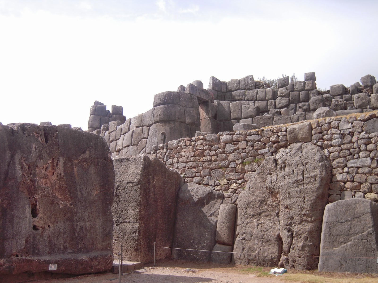
The stone ruins of Saqsayhuaman. The top most stones display an excellent example of precise Inca stone masonry. 
After a disappointingly short time spent at the site (we needed to move on in order to see everything on the schedule AND catch a train later that day), we got back on the bus to continue into the valley. Our guide, Patrick, told us that during that section of the ride, we were ate the highest altitude of our Cuzco trip -- just under 3,600 meters. Even Machu Picchu was lower than that. Driving through the Andes was amazing because the slopes were so huge and everything was green, brown and very rugged. Every so often, we would see the clusters of tile collections that signified a small Andean settlement. On the way, we saw the round tower-like ruins of Pacapucara, which was more than likely an Inca stronghold or lookout post as its name means "red fortress" in Quechua. Patrick speaks fluent Quechua, and even treated us to a small lesson on the bus.

We drove through a valley that still had Inca-age terraces on the mountainside and current farm fields in the valley. Even though there were modern roads, cards, and telephone wires, you could alost feel that time and conquest had not passed and that the people living in the towns and fields were livling in much of the same way as the Incas had. 

Our next stop was the little town of C'orao, a place known for its fine quality alpaca and llama products. Here we stopped at the living museum of Awana Kancha, a place dedicated to the preservation and practice of traditional textile weaving, coloring and making. They had live alpacas that we could pet, feet and take pictures with as well as an excellent display of traditional pigments used for dyeing. 

Feeding the llamas at Awana Kancha. They broke their way out of their pens to come and play with us. 

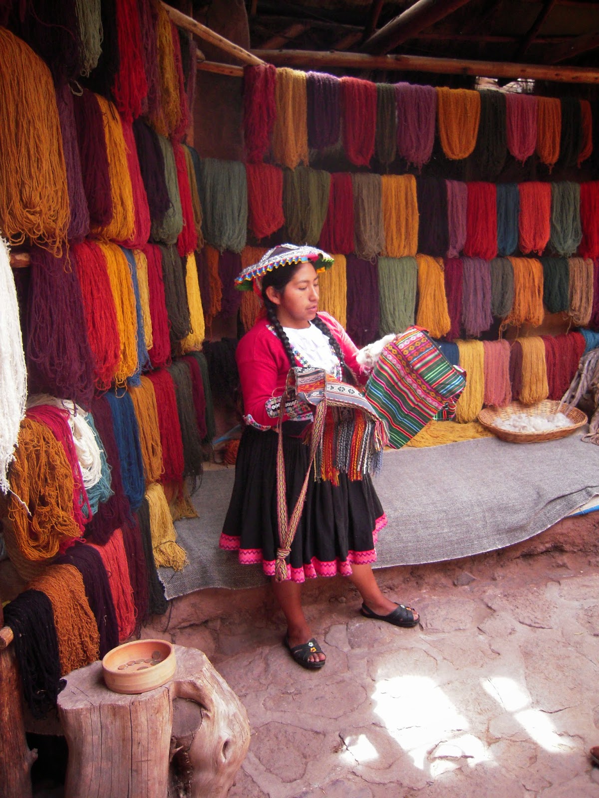
A traditional textile expert at Awana Kancha. She showed us the natural ingredients used to make different colors as well as taught us how to tell the difference between natural and synthetic wool products. 
Women in traditional Andean clothing sat barefoot along the path, working traditional looms and demonstrating how the fabric was made. They had a fancy store of their finished products, all of which were very beautiful and very, very expensive.

After the pleasant stop in C'orao (none of us thought we would have had the chance to feed and pet llamas!) we continued with our Sacred Valley tour until we reached the Mirador Turay, the spot on the side of the road that offers the classic yet beautiful view of the Sacred Valley of the Incas. Running between the base of the peaks in the distance is the Vilcamayo -- which means sacred river -- later renamed Urubamba by the Spanish. 

The "classic" view of the Sacred Valley of the Incas.

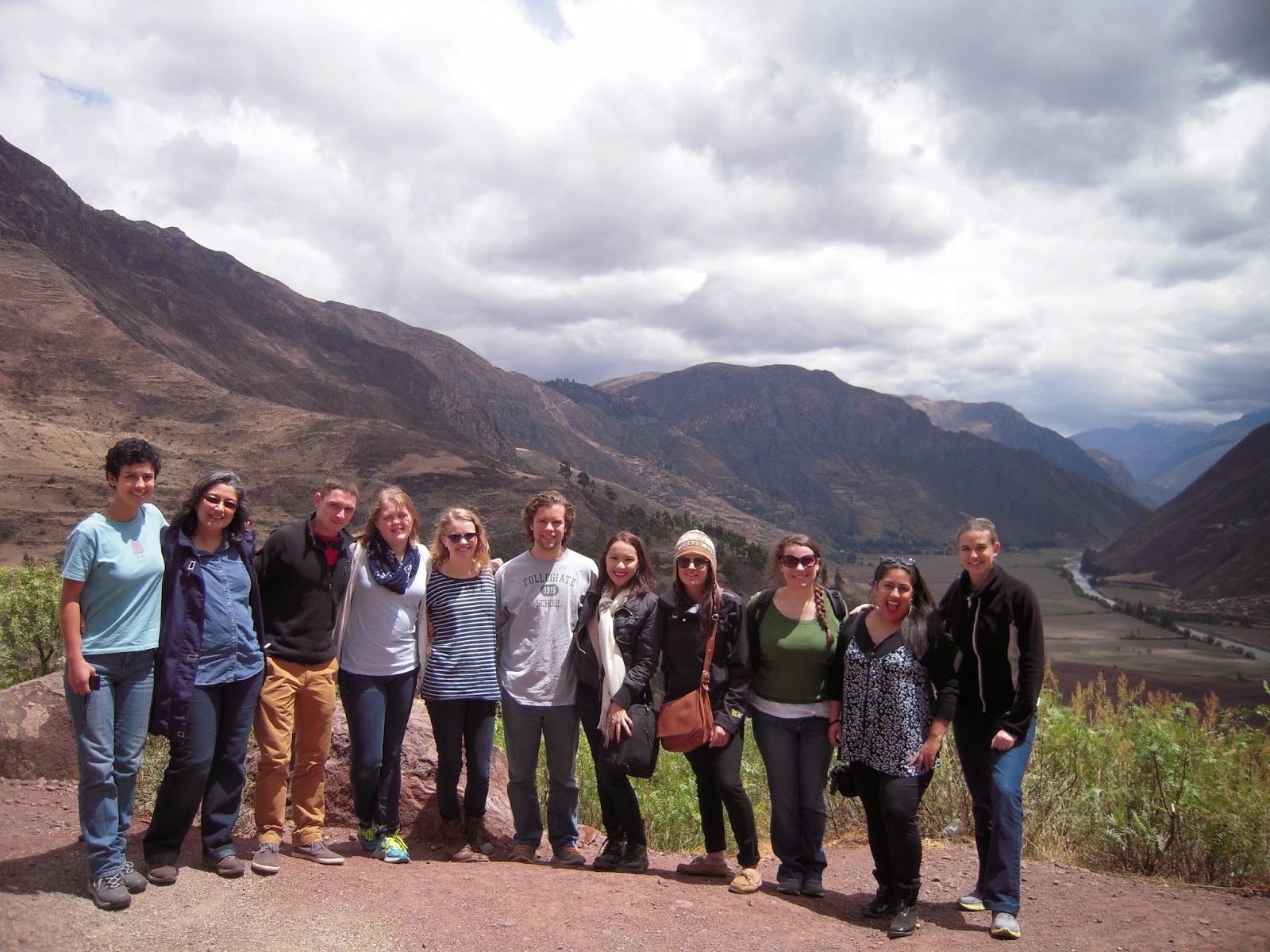
The entire CIEE group in the Sacred Valley from left to right: Alicia, our professor Sonia, Garrick, Jesse, Natalie, Hank, Ariana, her friend Stefanie, Me, Andrea, and our program adviser Marion.
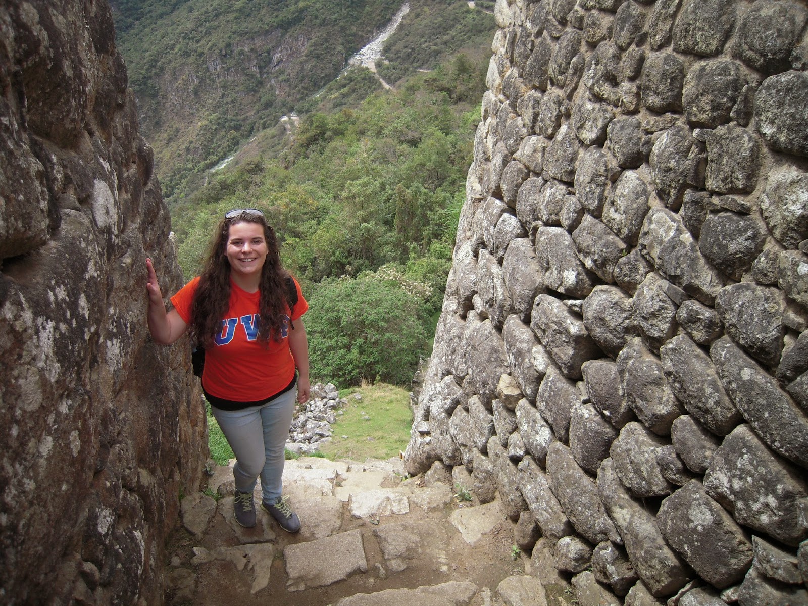
Our next stop on our tour was the town of Pisaq -- also spelled Pisac -- which is a settlement at the base of a huge terraced, green-faced Andean peak. Pisaq also had Inca ruins, a old settlement with a breathtaking view of the surrounding slopes and fields. Here we were able to see the traditional leveled terraces used by the Incas for high altitude agriculture. These terraces -- which are now protected -- are slowly being destroyed, ironically because they are not being used. We climbed all the way to the top of the settlement, a demanding climb in and of itself, let alone combined with extremely high altitude, but the view was worth it.

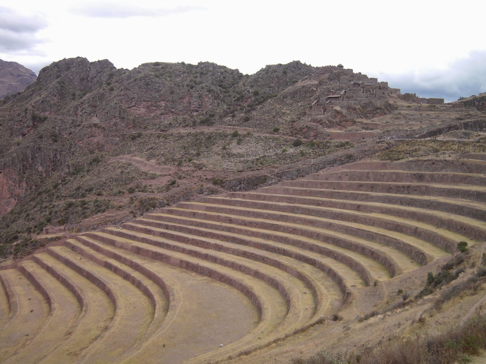
The terraced agriculture fields used by the Incas at Pisaq. 

A view of the scenery from the top of the Pisaq settlement. 
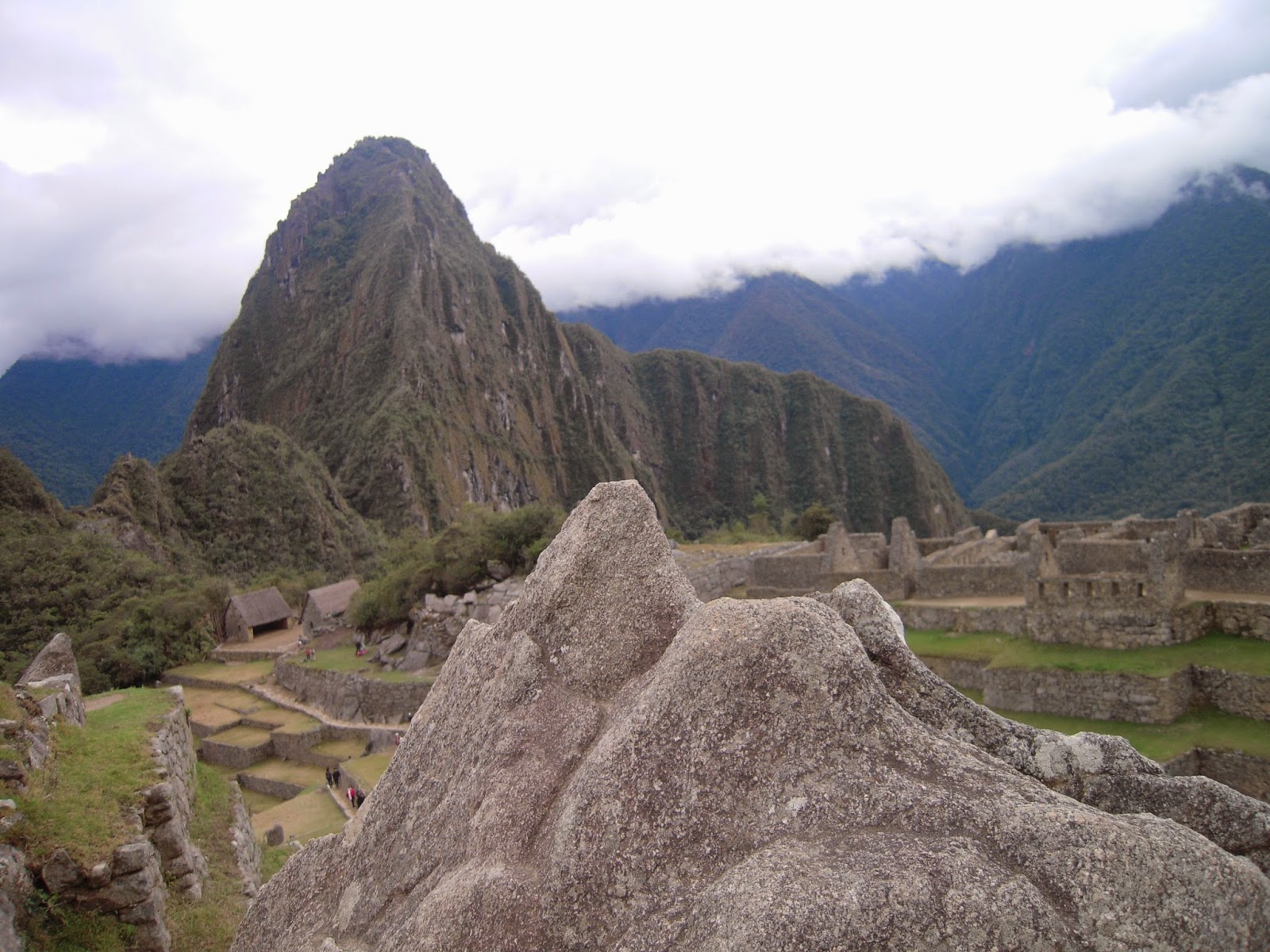
Our final stop of the tour was in Ollantaytambo, a beautiful city with some of the best Inca ruins outside of Machu Picchu. I fell in love with it from the moment we arrived. It's located in the middle of three majestic peaks in the same spot where three valleys converge, making it a wind tunnel in the extreme. Ollanta was the star of the Inca version of Romeo and Juliet, and Tambo was where he made his last stand against Emperor Pachacutec. Thus, the place is now named after him. The town is in the valley and the Inca ruin attractions are on the mountainsides all around it.

One one of the mountainsides sits the ruins of Ollantaytambo itself, an unfinished Inca project from right before the Spanish conquest. Experts believe it was meant to be a sun temple because the rays from the sun during the summer solstice rises behind the eastern peak and would fall directly on the ruins. In ancient times, the ruins would have held plates of sliver and gold, setting the entire valley alight with shimmering light. Unfortunately, the project was never completed due to the outbreak of civil war between Atahualpa and his brother Huascar. After this conflict, the Spanish arrived, and so Ollantaytambo now sits unfinished, a masterpiece of unrealized potential. 

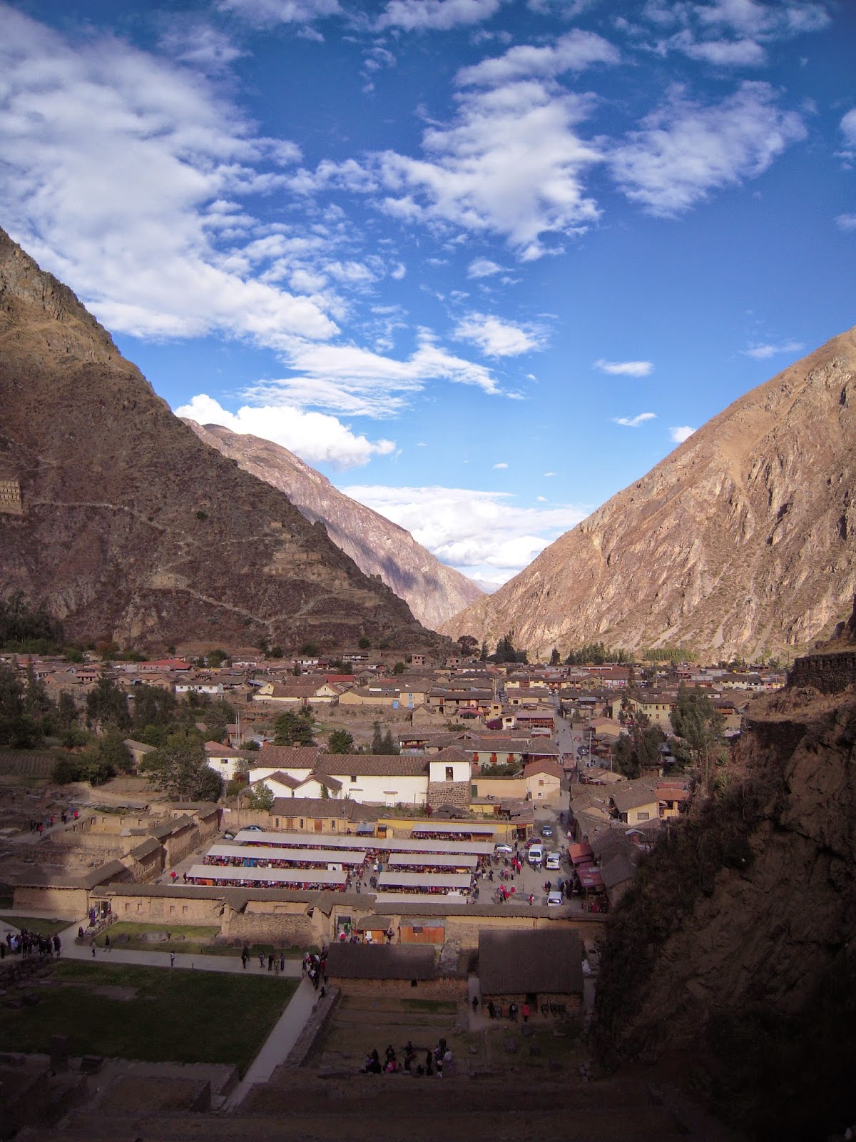
A view from the ruins overlooking the modern town and the giant peaks of the surrounding mountains. 

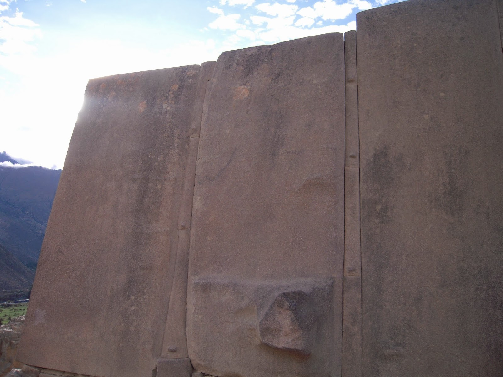
A famous wall near the top of the ruins. The rounded bump in the middle of the bottom panel used to be a carved jaguar head, one of the sacred animals of the Incas, but it's believed that when the Spanish arrived, they smashed off the carved heads in an effort to destroy the traces of indigenous culture and religion. 
On the upside, the unfinished site does give us a little insight into how the Incas managed to build their wonderful structures. Large unincorporated stones sat near the top, and Patrick explained a theory in which the Incas used knowledge of local plants to make a kind of acid to make their super straight cuts in the massive stones. We climbed all the way to the top of Ollantaytambo and were able to look down on the entire valley.

Off to the west, through a gap in the peaks, we were able to see distant peaks that were capped in snow. The three mountains that surrounded the Ollantaytambo Valley had peaks so high, the clouds swirled around the tips. Across the valley on the opposite peak, we saw a columned yellow stone fortress built into the mountainside. To its left, was a face-like natural rock formation that apparently resembles one of the Inca gods. 

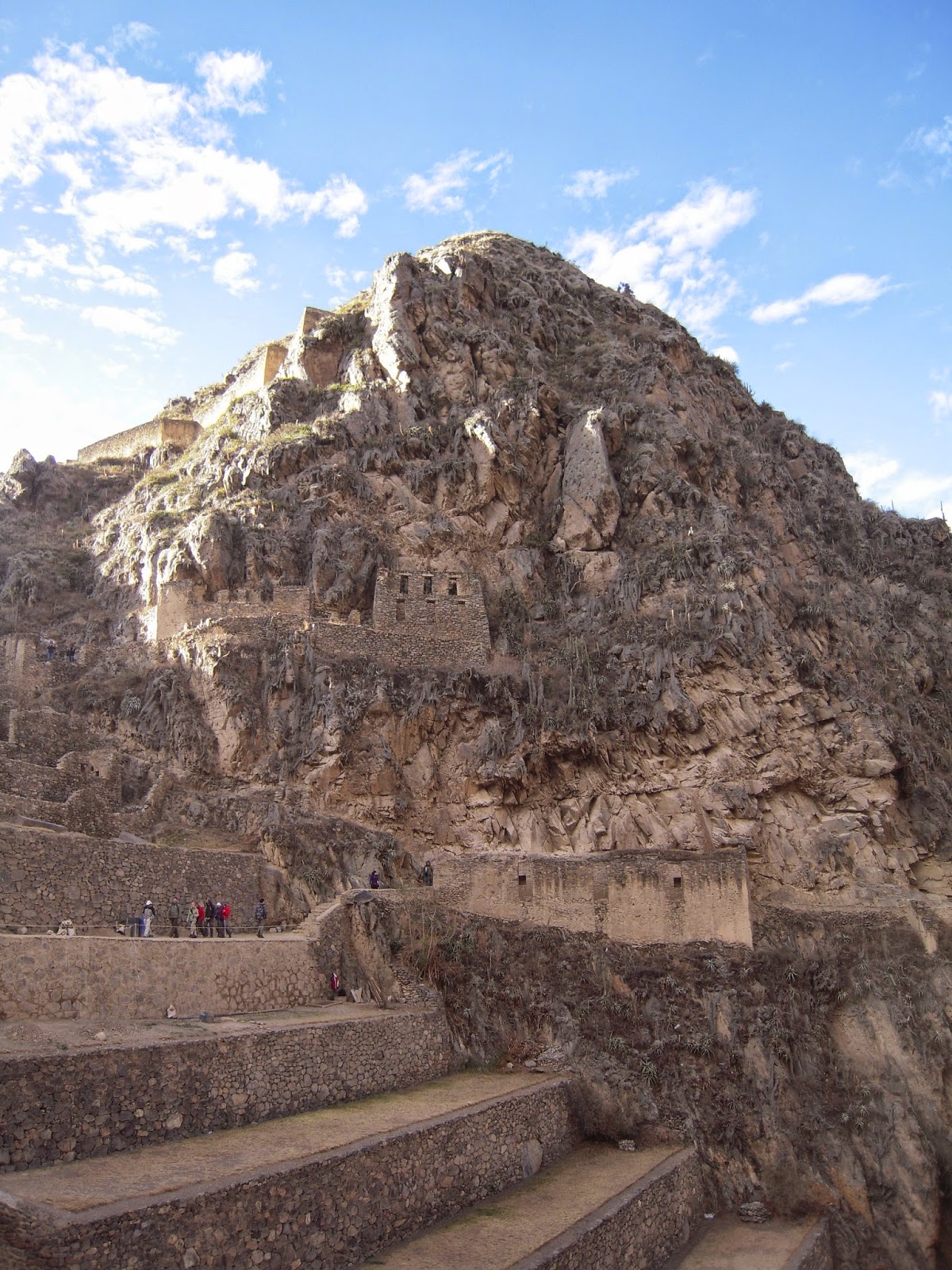
The incomplete temple of Ollantaytambo cut into the mountainside. 
After we were finished taking in the breathtaking sights, we descended back into the town to kill some time before our train left. A few of the other students and I bought beef kebabs from a street vendor which were delicious. I followed a stone path that ran on top of an ancient terrace in the modern town. On one side was one of the famous gurgling canals that are present all through the town along with the well-kept gardens of beautiful flowers. On the right side of the lower terrace, I could see the backyards of some of the local residents. The houses were rather run down and their animals roamed free, but brightly-colored laundry snapped from the clothes lines, and the people and their children laughed and talked. It was neat to get away from the tourist places and see something more akin to real life.

After a lovely day, we regrouped at the train station to depart. The train had glass ceiling windows, but because it was night, we couldn't see much. Instead, we played a rousing game of Uno, and finally arrived in our hotel in Aguas Calientes, the mismatched tourist down at the base of the mountain, and the starting point for our final stop in our journey -- the ruins of Machu Picchu.  

Cuzco and the Sacred Valley -- Our Inca Journey: Day One

After a busy month and a hectic couple of weeks of study and preparation for our midterms, I finally have the time to seriously sit down and write about the amazing, once-in-a-lifetime trip that we took to Cuzco and the Sacred Valley of the Incas. It was a four day weekend filled with history, culture, travel, and wonderful panoramic mountain views.

Our trip began very early on a Thursday morning, which necessitated our rising at 3:45 a.m. in order to catch a 6:50 a.m. flight out of Lima. After a week of classes, we waited in the airport, exhausted but ready to travel. Our plane was a tiny little thing that would take us on the hour long journey east over the Andes Mountains to land in the city of Cuzco, approximately 3,400 meters or 11,150 feet above sea level. Because I somehow scored a prime window seat, I was able to see the flat coastal area of Lima fall away to be replaced by staggering brown peaks of the start of the Andes. From our altitude, we looked down upon the mountain tops as they broke through the clouds; they looked like islands with the swirling white clouds flowing between them like ocean water.

The city of Cuzco, nestled in a valley between towering Andean peaks.
I have never been at a high altitude before, so I wasn't sure what to expect when I stepped off the plane. However, the first deep breath I took was as cool and sweet as a brisk November day, and I luckily didn't suffer from any adverse affects from the altitude.

Our bus picked us up at the airport and trundled us away to the Royal Inca 2 Hotel, close to the Plaza de Armas in the center of Cuzco. As we passed through the heart of the city, the cobbled streets and colonial architecture transported us back in time, and it seemed as if the setting and atmosphere belonged to Rome or Venice, not the middle of the Peruvian mountains.

A colonial arch at the beginning of one of the main avenues. 

A Spanish-era cathedral in the Plaza de Armas during sunset. Cuzco, Peru.
On the first day in Cuzco, it is highly recommended that you take it easy so as not to over exert yourself at the high altitude. With this in mind, most of the students in our group rested in the hotel, but a friend and I decided we would go out and explore the city instead -- at a very slow place. One thing I wanted to see was the convent of Santo Domingo that sits on top of the ruins of Koricancha, the ancient Inca sun temple that once stood covered in gold. Even though the gold had been stripped away in the 16th century to help pay for Pizarro's ransom of Inca emperor Atahualpa, the stones still stand, black and dark grey in a curved wall beneath the ornate colonial convent. Both still stand in tandem, and it was impressive to stand there and gaze at all that history and how it was preserved throughout the centuries.

The convent of Santo Domingo is the large building on top. Beneath it, you can see the black walls of Koricancha. Though it's hard to see in the picture, the stones of Koricancha are fitted together with amazing precision, without mortar. The Spanish built the church atop the temple ruins as a symbol of strength and superiority, yet in one of the numerous earthquakes, many of the Spanish colonial structures were destroyed, revealing the much sturdier and older Inca ruins beneath.
After Koricancha, we simply lost ourselves in the cobbled winding streets of Cuzco. Cuzco is one of the most beautiful cities in the world because it is a jumble of antiquity and modernity, and relics of the Spanish and Incas can still be seen. The most impressive of the Spanish contribution are the stunning, giant cathedrals and basilicas that dot the city, with beautiful crenelations and 16th century architecture -- especially the two that stand in the Plaza de Armas. These two giant churches take up two sides of the square, and yet in the middle is an elaborate carved fountain with a gold statue of Pachacutec, a great Inca emperor. This is perfect symbolism of how these two cultures continue to coexist in Cuzco.
Statue of Pachacutec as he points towards the mountains.
The feel of Cuzco is very colonial with its carved wooden balconies, ornate lampposts, and narrow, winding lanes and staircases that traverse the rolling city, and yet the streets are filled with Peruvians in traditional Andean bright clothes and bold prints, and many of the street names are in Quechua. We even saw a woman on a street corner with a platter of six or seven cuyes, or roasted guinea pig. 

Later in the evening, we ventured out to an Andean craft market to shop and bargain for souvenirs. Cuzco is considered to be a main location to buy products made from llama and alpaca wool, and the vendors are more than happy to haggle with you in order to earn your business. We even got the chance to meet a sweet baby lamb from a kindly Andean woman we met. Later, we crossed through the Plaza de Armas at night on the way back to our hotel, and saw the surrounding slopes lit up with blue and orange balls of light, marking the homes of those living in the outskirts of the city.